
Description
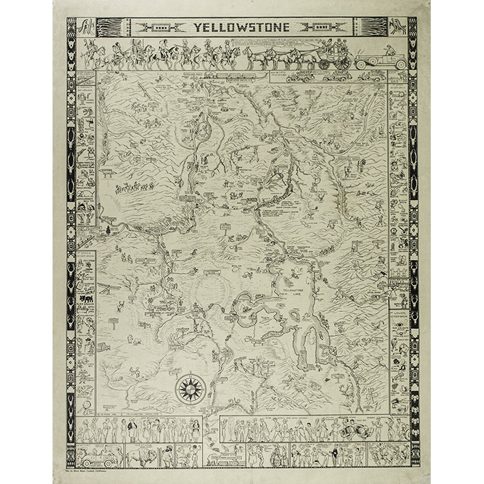
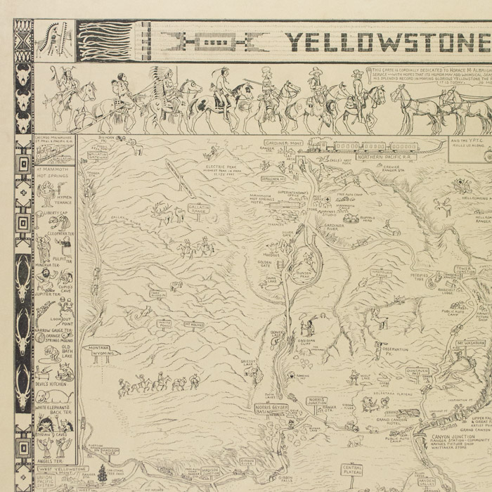
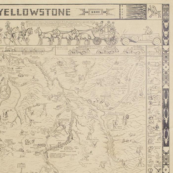
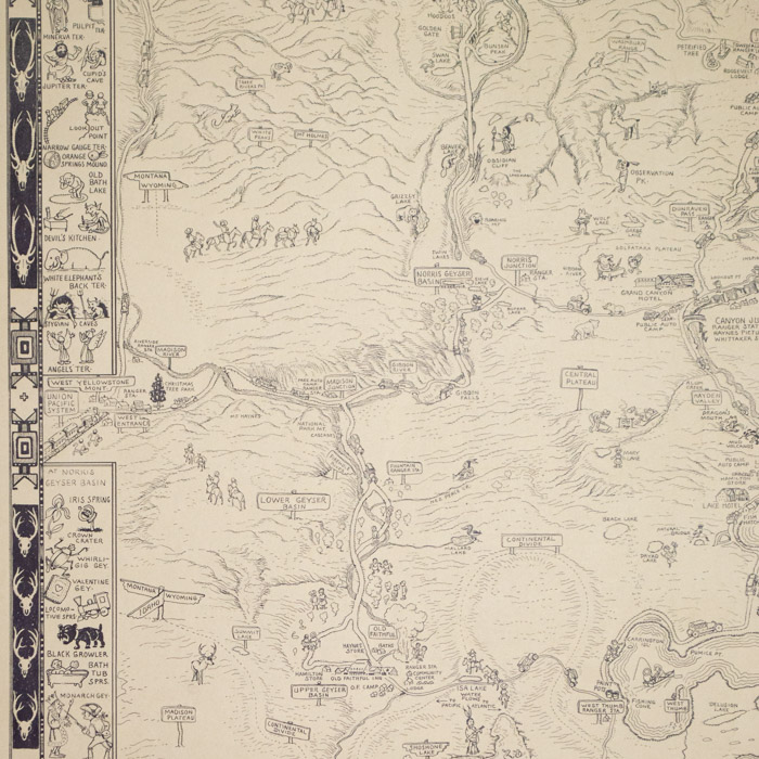
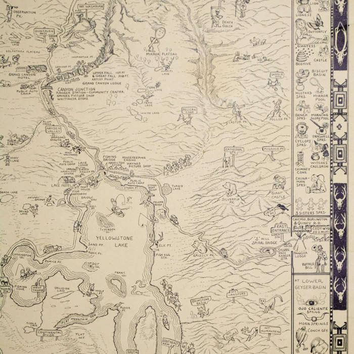
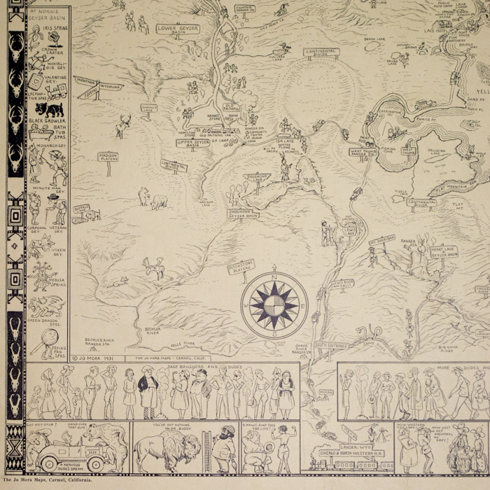
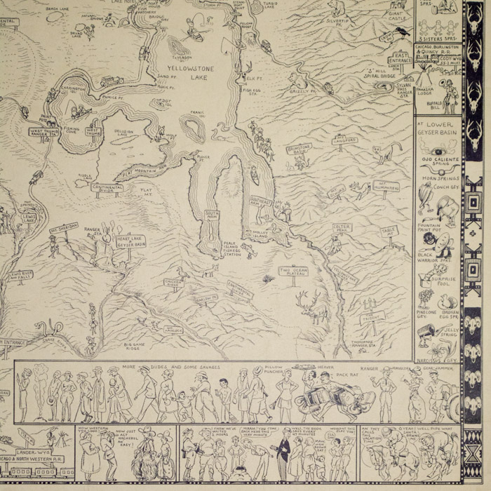
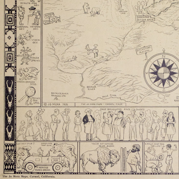
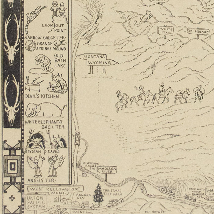
The map title is rendered as if a woven textile in the Native American manner, as are the narrow decorative bands left and right, which incorporate geometric designs and stylized buffalo, pronghorn antelope and deer skulls. Beneath the top is a humorous illustration of a frustrated motorist stuck behind a stagecoach, which is facing Native Americans, a fur trader and cowboys on horseback, alluding to the history of the area during the Westward Expansion in the 19th century. Bands of vertical illustrations have pictorial illustrations with literal depictions of the names of Yellowstone’s features, such as a horned devil working at a stove for “Devil’s Kitchen” and a figure of Medusa in toga and sandals for “Medusa Spring.” Along the bottom are cartoons panels that poke fun at tourist behavior. There is a compass rose lower left.
Joseph Jacinto “Jo” Mora was one of the foremost pictorial mapmakers of the 20th century. According to art historian Mary Murray, it is in the pictorial maps that he created “an art form uniquely his own” that “exemplify the popular, entertaining, direct, and informative art at which Mora excelled.” His maps are characterized by humor — often with portrayals of whimsical cartoonish characters and pun-related references — simultaneously combined with detailed geography and historical references. The intent, as described by geography historian Stephen J. Hornsby, was to use “humor to make other content more interesting.”
The year after he was born in Uruguay, Mora’s family moved to the United States, eventually settling in Boston. He attended the Art Students League in New York, and by his early 20s was working as a cartoonist and illustrator for Boston newspapers and children’s book publishers. He began taking trips to the American west and Mexico in the 1890s and relocated permanently to the West in 1903, spending three years living in Arizona, drawing and studying the Hopi and the Navajo cultures. In 1920 he moved to the Monterey Peninsula of California, where he spent the rest of his life in Pebble Beach and Carmel. Like many pictorial mapmakers, Mora had wide-ranging interests and a combination of talents as an artist proficient in many media, a cartographer, a historian and an author. Over a career spanning almost 50 years, Mora illustrated several books for children as well as books on California history, completed commissioned realist sculpture and murals, and made paintings in oil and watercolor. His most original and best-known works, however, are his distinctive pictorial maps and chartswhich he referred to as “cartes.” These were mainly of places in California and include California’s Playground (1926), Monterey Peninsula (1927), The Seventeen Mile Drive (1927), California (1927), Grand Canyon (1931), Yosemite (1931) Yellowstone (1931), Ye Old Spanish Main (1933), Carmel-By-The-Sea (1942), Map of Los Angeles (1942) and a later version of California (1945). He also designed and illustrated the posters Indians of North America (1936) and The Evolution of the Cowboy (1933).
Dedication beneath title: “This carte is cordially dedicated to Horace M. Albright — Director U.S. National Park Service — with hopes that its humor may add whimsical seasoning to his splendid record in making glorious Yellowstone the facile pageant it is today. Jo Mora.”
Full publication information: © Jo. Mora 1931. The Jo Mora Maps, Carmel, California.
Condition: Generally very good, recently professionally cleaned and deacidified, also backed on Japanese tissue to repair a few short tears and scattered light creasing in outer margins, now with only light remaining toning, wear, handling,
References:
“About.” Jo Mora Trust. 2021. https://jomoratrust.com/about/ (7 June 2021).
Burton-Carvajal, Julianne. “Back to the Drawing Board with Artist Jo Mora: Illustrated Chronologies of his Life, Works, and Exhibitions.” Noticias del Puerto del Puerto de Monterey, Quarterly Bulletin of the Monterey History and Art Association. Vol. 52: 3. Fall 2003. p. 15. https://www.mayohayeslibrary.org/uploads/2/5/3/9/25392173/vol_52_num_3_fall_2009.pdf (25 March 2022).
Hiller, Peter. The Life and Times of Jo Mora: Iconic Artist of the American West. Kaysville, Utah: Gibbs Smith, 2021.
Holmes, Nigel. Pictorial Maps. New York: Watson-Guptill, 1991. p. 45
Hornsby, Stephen J. Picturing America: The Golden Age of Pictorial Maps. Chicago: University of Chicago Press, 2017. pp. 28-31, 57.
Pilchen, Lloyd. “Exhibition of Jo Mora’s Whimsical Map Delights.” 29 January 2022. The American Surveyor. https://amerisurv.com/2022/01/29/exhibition-of-jo-moras-whimsical-map-delights/ (22 March 2022).


